Pick your community for local water levels, flood history, permit offices and records. Each guide is researched separately from official sources.
Explore your waterfront
Explore the coast. Find your starting point.
The St. Johns River, its creeks, the Intracoastal Waterway and the ocean shore each raise different seawall and bulkhead questions. Pick your community for local water levels, permit offices and records.
Full local guide
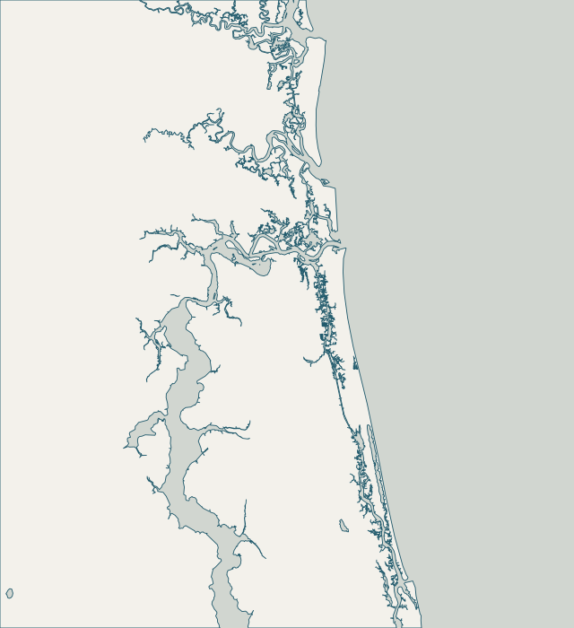
Choose a label to open local resources →Tap a community on the map or below ↗
Land: U.S. Census Bureau county geometry minus Census TIGER water. Place markers: USGS Geographic Names Information System. Snapshot: October 24, 2026. General reference only; not a survey, flood map or service-availability boundary.
Your local starting point
Find your community.
Choose a guide for local maps, permit starting points and the records to gather for your property.
San Marco fronts the main stem of the St. Johns River just south of downtown, where the river is wide and wind has a long run to build waves. The city’s 2026 living-shoreline model says this reach is largely bulkheaded already and needs hard structures because of that wave energy. Normal tide range downtown is only about 2 feet, so storm surge, not daily tide, sets the risk.
Riverside and Avondale run along the west bank of the St. Johns River south of downtown, with Willowbranch Creek and Big and Little Fishweir creeks cutting inland. Both are National Register historic districts reaching to the river, and Riverside Avondale is one of only three locally designated historic districts in Jacksonville, where exterior and site work needs a Certificate of Appropriateness.
Ortega is a peninsula bounded by the St. Johns River and the Ortega River, and the Old Ortega National Register district runs between them. The St. Johns side is open, high-fetch water where the city’s shoreline model expects bulkheads. The Ortega River is a calmer tributary that the same model names as a likely place for living shorelines.
Lakeshore is on the west side of the Ortega River near the mouth of the Cedar River, west of the Ortega peninsula. These are sheltered tributaries off the St. Johns, but storm surge funnels into them. In Irma the Cedar River gauge recorded a 5.66-foot storm tide above normal high water, the highest of the Duval tributary gauges in the Weather Service’s report.
San Jose lies on the east bank of the St. Johns River south of downtown and includes the mouth of Christopher Creek. Epping Forest, on Christopher Point, has been on the National Register since 1973, and houses in the San Jose Estates group are individually listed. The city’s shoreline model treats this reach as bulkhead shoreline because long fetch drives chronic erosion.
Beauclerc sits on the east bank of the St. Johns River between San Jose and Mandarin, close to the Buckman Bridge and Plummers Cove. The city’s shoreline model calls for bulkheads along this reach because wind has a long run across the river. Normal tide range at the Buckman Bridge is only about 1 foot.
Mandarin lies on the east bank of the St. Johns River in southern Jacksonville, from Goodbys Creek south toward Julington Creek. Its river frontage faces wide, open water where the city’s shoreline model expects bulkheads; Goodbys Creek is a narrow tributary reaching the river through a dredged channel. Normal tide range is about 1 foot.
Julington Creek runs into the St. Johns River at Mandarin’s southern edge. Census boundary data shows its lower reach as the Duval–St. Johns county line, so north-bank owners use the City of Jacksonville and south-bank owners use St. Johns County. The city’s 2026 shoreline model names Julington Creek as a likely place for living shorelines.
Arlington lies east of the St. Johns River, with waterfront on the main river, the Arlington River and Pottsburg Creek. Tide range grows downriver from about 2 feet downtown to about 3.7 feet at Dames Point. The Weather Service calls the Pottsburg Creek area near the Beach Boulevard ramp prone to tidal flooding.
Intracoastal West covers City of Jacksonville neighborhoods on the west bank of the Intracoastal Waterway (Pablo Creek), such as Isle of Palms and Pablo Keys. These lots are inside the consolidated city, so permits go through JaxEPICS rather than the Beaches cities. The Intracoastal keeps a daily tide range of roughly 4–5 feet with near-ocean salinity.
Fort George Island and the Sisters Creek and Fort George River marshes lie in Jacksonville’s Northside, within the Timucuan Ecological and Historic Preserve, where much of the land is privately owned. State map data places the Fort George River, Sisters Creek and Fort George Inlet inside the Nassau River–St. Johns River Marshes Aquatic Preserve.
Mayport village sits where the St. Johns River meets the Atlantic and the Intracoastal Waterway. NOAA’s Mayport gauge shows a daily range of about 5 feet, and the city’s flood map puts the village waterfront park in zone AE with a base flood elevation of 8 feet NAVD88, the highest of the Jacksonville neighborhoods in this guide.
The Trout and Ribault rivers are tributaries on the north side of the St. Johns in Jacksonville’s Northside. The city’s 2026 shoreline model found most of their banks suitable for living shorelines or not needing stabilization, and names Ribault River Preserve as a candidate public living-shoreline site. The Jacksonville Zoo near the Trout River mouth has the city’s only built living shoreline.
The Southbank and downtown riverfront line both sides of the St. Johns River at the Main Street Bridge, where public Riverwalk bulkheads meet private condo and commercial walls. Normal tide range is about 2 feet, but Irma set the gauge’s all-time record at 5.57 feet NAVD88, driven by a preceding nor’easter, high tides, surge and rain together.
Jacksonville Beach is a separate city inside Duval County, with Intracoastal Waterway frontage on its west side and the Atlantic on its east. Census counts about 7.3 square miles of land and 14.6 square miles of water inside the city limits. Its Intracoastal walls see ocean-type tide range and salinity, while oceanfront property falls under Florida’s coastal construction rules and the federally authorized Duval County shore protection project.
Atlantic Beach lies between the Atlantic Ocean and San Pablo Creek on the Intracoastal Waterway. Its 2025 flood-risk adaptation plan names Hopkins Creek, Sherman Canal, Puckett Creek and Sherman Creek as major drainageways, with Hopkins and Sherman creeks influenced by tides and storm surge. The city has recorded flooding from Irma, Matthew, Nicole and the November 2015 nor’easter.
Neptune Beach is a separate Duval County city between Atlantic Beach and Jacksonville Beach, with about 2.3 square miles of land and 4.5 square miles of water inside its limits. Its waterfront includes the Atlantic shore, covered by the federal Duval County shore protection project, and low-lying areas draining toward the Intracoastal side.
Ponte Vedra Beach and neighboring Palm Valley sit in unincorporated St. Johns County, between the Atlantic and the Intracoastal Waterway. USGS places Ponte Vedra Beach near the ocean and Palm Valley along the waterway. Permits come from St. Johns County, not the City of Jacksonville. The oceanfront has been reshaped by Matthew, Irma, Ian and Nicole and by the county’s 2024 beach restoration.
Fruit Cove is a census-designated community in northwest St. Johns County on the St. Johns River, with Switzerland to the south and the mouths of Julington Creek and Durbin Creek to the north and east. On this stretch of river the daily tide range is only about 1 foot, but Hurricane Irma pushed Julington Creek 5.35 feet above normal high water in 2017.
St. Augustine sits on the Matanzas River behind Anastasia Island in St. Johns County. Davis Shores and Salt Run are on the island; Vilano Beach is across the inlet to the north. The city reports that 90% of its area is in a flood zone, and its bayfront high-water marks reached 7 feet NAVD88 in Matthew and 6.75 feet in Irma.
Orange Park is an incorporated town in Clay County on the west bank of the St. Johns River, south of the Buckman Bridge and north of the mouth of Doctors Lake. Census records about 3.6 square miles of land and 1.7 square miles of water. Here the river’s daily tide range is only about 1 foot, and its water is brackish to nearly fresh.
Fleming Island is a census-designated community in Clay County between the St. Johns River and Doctors Lake, with about 15.8 square miles of land and 7.3 square miles of water. The St. Johns River Water Management District describes Doctors Lake as a 3,400-acre lake with poor circulation because of its narrow connection to the river.
Green Cove Springs is a city on the west bank of the St. Johns River in Clay County, with about 8.6 square miles of land and 2.7 square miles of water. The mouth of Black Creek lies to the north. The river’s daily tide range near the Shands Bridge is about 1 foot, but storms have pushed the river more than 3.5 feet above normal high water.
Fernandina Beach is the Nassau County city on Amelia Island, facing the Amelia River and Egans Creek on the west and the Atlantic on the east. NOAA’s Fernandina Beach gauge, with records back to 1897, shows a daily tide range of about 6.6 feet and normal high water about 2.74 feet above NAVD88, the largest of the area’s long-term gauges.