Intracoastal West seawall and bulkhead planning
Isle of Palms, Pablo Keys and nearby neighborhoods sit on the Intracoastal Waterway inside the City of Jacksonville, not the Beaches cities. Their flood elevations are among the highest in Duval.
Describe your project on this page ↓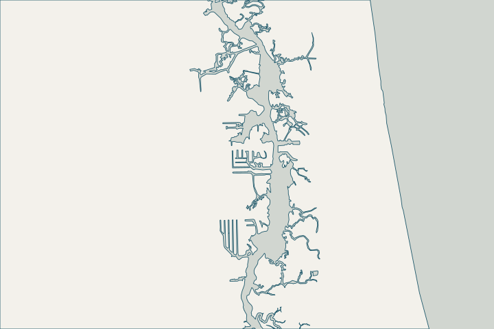
Get to know your waterfront
Intracoastal West covers City of Jacksonville neighborhoods on the west bank of the Intracoastal Waterway (Pablo Creek), such as Isle of Palms and Pablo Keys. These lots are inside the consolidated city, so permits go through JaxEPICS rather than the Beaches cities. The Intracoastal keeps a daily tide range of roughly 4–5 feet with near-ocean salinity.
Representative coordinates: Intracoastal West / Pablo Creek (Duval ICW communities) · St. Augustine Beach and ICWW station datums (8720587, 8720494, 8720398, 8720305, 8720267) · Zoning FAQs
High water, salt water and marsh
The city’s flood map puts the Isle of Palms point in zone AE with a base flood elevation of 7 feet NAVD88, and Pablo Keys at 6 feet. In Nicole, water covered docks and yards near Isle of Palms and approached homes in the Hammocks of Oak Landing; Ian’s surge there matched Irma’s. Representative coordinates: Intracoastal West / Pablo Creek (Duval ICW communities) · Post Tropical Cyclone Report: Hurricane Nicole (PSHJAX) · Post Tropical Cyclone Report: Hurricane Ian (PSHJAX)
Salty water means marine borers in timber and fast corrosion of steel in the splash zone. Ask the assessor to inspect at low tide. Wood-Boring Marine and Estuarine Animals in Florida (SGEB-15) · UFM 4-150-07 Waterfront Facilities: Operation and Maintenance
Many lots meet salt marsh, which the city’s shoreline model left out because it is already natural and fairly stable. Where a wall meets marsh, expect wetland and state-lands review. Living Shoreline Suitability Model (LSSM) report · Explanation of Sovereign Submerged Lands (SSL) and the Linkage Between Proprietary Authority and Regulatory Authority in ERP
What could the work cost?
Salt-water durability and dock repairs often dominate cost here; price them together.
Published prices are attributed planning context from contractors’ own pages, not a measured Jacksonville average or this website’s quote. Ranges differ about five-fold between publishers; your written, itemized scope decides the real number.
Compare quotes and plan a budget →Find the relevant permits and records
| Starting point | What to resolve | Prepare and look up |
|---|---|---|
City of Jacksonville Building Inspection Division | Building permit through JaxEPICS after zoning, drainage and any flood or historic review; inspections. | Signed and sealed drawings, survey and site plan as unlocked PDFs. 214 N. Hogan St.; 904-255-8500. |
Florida DEP Northeast District (Jacksonville) | State environmental resource permit or exemption, and state-lands consent for work at or below the high-water line. DEP handles single-family docks and shore protection not tied to a larger development. | Survey with the existing wall face and high-water line, the proposed alignment and photos. DEP Northeast District: 904-256-1700. |
U.S. Army Corps of Engineers, Jacksonville District | Federal authorization for work in tidal and navigable waters, often verified by DEP through the state programmatic general permit or covered by a nationwide permit. | Ask DEP whether its review includes federal verification for your scope, or which nationwide permit applies. |
An Intracoastal West checklist
Use these steps to prepare.
Pull your permit and parcel history
Search past permits in JaxEPICS (guest sign-in) and look up your parcel with the Duval County Property Appraiser before the assessment.
Services Provided: Violation or Permit Record Search · Duval County Property Appraiser
Ask for your flood zone and elevation certificate
The city’s floodplain coordinator (904-255-8366) provides flood zone determinations and copies of available elevation certificates.
Confirm city limits
Lots east of the waterway may be in Jacksonville Beach or Atlantic Beach, which issue their own permits.
Plan your Intracoastal West seawall project
Tell us where your Intracoastal West property is, what you have noticed and what you want to decide. We will help you plan the next step.
Local guidance. A clearer plan for your waterfront.
Intracoastal West project questions
Am I in Jacksonville Beach or the City of Jacksonville?
Isle of Palms and Pablo Keys are inside the City of Jacksonville. Check your address on the Property Appraiser site to be sure.
Representative coordinates: Intracoastal West / Pablo Creek (Duval ICW communities) · Duval County Property Appraiser
Keep planning
Nearby waterfront guides
Jacksonville Beach, Atlantic Beach, Neptune Beach, Arlington
Show sourcesHide sources
- Representative coordinates: Intracoastal West / Pablo Creek (Duval ICW communities)Source reviewed 2026-10-24
- St. Augustine Beach and ICWW station datums (8720587, 8720494, 8720398, 8720305, 8720267)Source reviewed 2026-10-24
- Zoning FAQsSource reviewed 2026-10-24
- Post Tropical Cyclone Report: Hurricane Nicole (PSHJAX)Source reviewed 2026-10-24
- Post Tropical Cyclone Report: Hurricane Ian (PSHJAX)Source reviewed 2026-10-24
- Wood-Boring Marine and Estuarine Animals in Florida (SGEB-15)Source reviewed 2026-10-24
- UFM 4-150-07 Waterfront Facilities: Operation and MaintenanceSource reviewed 2026-10-24
- Living Shoreline Suitability Model (LSSM) reportSource reviewed 2026-10-24
- Explanation of Sovereign Submerged Lands (SSL) and the Linkage Between Proprietary Authority and Regulatory Authority in ERPSource reviewed 2026-10-24
- Online/Electronic Permit SubmissionSource reviewed 2026-10-24
- Building Inspection DivisionSource reviewed 2026-10-24
- Northeast DistrictSource reviewed 2026-10-24
- Operating Agreements ERP Permitting: DEP District Offices and the Water Management District OfficesSource reviewed 2026-10-24
- Operating Agreement Concerning Regulation Under Part IV, Ch. 373, F.S., Between SJRWMD and DEP (eff. 07/01/07)Source reviewed 2026-10-24
- Federal Permits and Coordination Agreements Between DEP, WMDs, and the U.S. Army Corps of EngineersSource reviewed 2026-10-24
- SPGP VI – 1. Shoreline Stabilization, Activity descriptionSource reviewed 2026-10-24
- Reissuance and Modification of Nationwide Permits (91 FR 768, Jan. 8, 2026)Source reviewed 2026-10-24
- Services Provided: Violation or Permit Record SearchSource reviewed 2026-10-24
- Duval County Property AppraiserSource reviewed 2026-10-24
- Floodplain ManagementSource reviewed 2026-10-24