Fernandina Beach and Amelia Island seawall planning
Amelia River walls see the biggest tides in Northeast Florida. The city is building a 1.1-mile resiliency seawall downtown, and its projects offer useful reference points.
Describe your project on this page ↓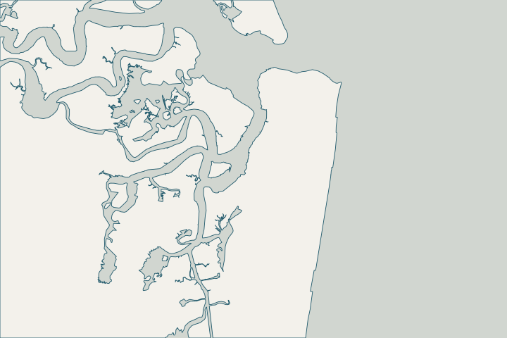
Get to know your waterfront
Fernandina Beach is the Nassau County city on Amelia Island, facing the Amelia River and Egans Creek on the west and the Atlantic on the east. NOAA’s Fernandina Beach gauge, with records back to 1897, shows a daily tide range of about 6.6 feet and normal high water about 2.74 feet above NAVD88, the largest of the area’s long-term gauges.
2024 Census Gazetteer: Florida places; USGS GNIS · Fernandina Beach 8720030 datums
Big tides mean a tall wet band
With about 6.6 feet between low and high water, a large part of the wall face wets and dries every tide. That is where steel corrodes fastest and where marine borers attack timber. Ask the assessor to inspect the full tidal band, ideally at low tide. Fernandina Beach 8720030 datums · UFM 4-150-07 Waterfront Facilities: Operation and Maintenance · Wood-Boring Marine and Estuarine Animals in Florida (SGEB-15)
The city’s waterfront projects
- A 1.1-mile downtown resiliency seawall along the Amelia River, planned in six phases.
- Waterfront Resiliency Segment One, bid in 2026: over 1,800 feet of steel sheet pile wall with a concrete cap, up to 72 check valves and outfalls with manatee grates.
- A $12.5 million Fernandina Harbor Marina redevelopment approved in 2026.
- An earlier request to replace 267 feet of marina seawall with a wall 4 feet taller.
LFIR #2838 Fernandina Beach Historic Downtown Resiliency Seawall Construction Project · City of Fernandina Beach #ITB 26-11 · Fernandina Beach Harbor Marina redevelopment · LFIR #2050 Fernandina Beach Shoreline Stabilization
What could the work cost?
Expect corrosion-resistant design choices to drive cost on the Amelia River. Ask how the design handles the full tidal band.
Published prices are attributed planning context from contractors’ own pages, not a measured Jacksonville average or this website’s quote. Ranges differ about five-fold between publishers; your written, itemized scope decides the real number.
Compare quotes and plan a budget →Find the relevant permits and records
| Starting point | What to resolve | Prepare and look up |
|---|---|---|
City of Fernandina Beach Building Department | Building permits before any improvements, repairs or alterations inside city limits; permitting is moving to the CityView system. | City Hall, 204 Ash Street; (904) 310-3135. |
Nassau County Building Department | Unincorporated Amelia Island and the rest of Nassau County, through an online Accela portal. | 96161 Nassau Place, Yulee; (904) 530-6250. Floodplain management: 904-530-6410. |
Florida DEP Northeast District (Jacksonville) | State environmental resource permit or exemption, and state-lands consent for work at or below the high-water line. DEP handles single-family docks and shore protection not tied to a larger development. | Survey with the existing wall face and high-water line, the proposed alignment and photos. DEP Northeast District: 904-256-1700. |
Florida DEP Coastal Construction Control Line program | Oceanfront walls and coastal armoring seaward of the control line, including eligibility and emergency rules. | Survey showing the control line, dune and structure; ask a coastal engineer about eligibility. Program line: 850-245-8570. |
An Amelia Island checklist
Prepare these before asking for a design.
City or county?
Fernandina Beach issues permits inside city limits; Nassau County covers the rest of Amelia Island.
Look up your flood hazard
Nassau County’s flood page explains Coastal AE and VE zones and links an address-searchable flood map.
Know your flood discount
Fernandina Beach is CRS class 5 (25%); unincorporated Nassau County is class 7 (15%).
Check aquatic-preserve limits
Fort Clinch State Park and the Nassau River–St. Johns River Marshes are aquatic preserves, where new seawalls waterward of high water are not allowed.
s. 258.39, F.S. – Boundaries of preserves (2026) · Rule 18-20.004, F.A.C. – Aquatic Preserve Management Policies, Standards and Criteria
Plan your Fernandina Beach & Amelia Island seawall project
Tell us where your Fernandina Beach & Amelia Island property is, what you have noticed and what you want to decide. We will help you plan the next step.
Local guidance. A clearer plan for your waterfront.
Fernandina Beach & Amelia Island project questions
How high has water reached at Fernandina Beach?
The NWS gauge lists 6.94 feet above normal high water in 1898 and 4.13 feet in Matthew (2016).
Is sea level rising at Fernandina?
NOAA measures about 0.91 inches per decade at Fernandina Beach for 1897–2025.
NOAA CO-OPS sea level trends (station 8720030 Fernandina Beach)
Does the city’s riverfront project include a living shoreline?
DEP describes the city’s Amelia Riverfront study as combining slope armoring with oyster-shell bags and marsh grass.
Keep planning
Nearby waterfront guides
Show sourcesHide sources
- 2024 Census Gazetteer: Florida places; USGS GNISSource reviewed 2026-10-24
- Fernandina Beach 8720030 datumsSource reviewed 2026-10-24
- UFM 4-150-07 Waterfront Facilities: Operation and MaintenanceSource reviewed 2026-10-24
- Wood-Boring Marine and Estuarine Animals in Florida (SGEB-15)Source reviewed 2026-10-24
- LFIR #2838 Fernandina Beach Historic Downtown Resiliency Seawall Construction ProjectSource reviewed 2026-10-24
- City of Fernandina Beach #ITB 26-11Source reviewed 2026-10-24
- Fernandina Beach Harbor Marina redevelopmentSource reviewed 2026-10-24
- LFIR #2050 Fernandina Beach Shoreline StabilizationSource reviewed 2026-10-24
- PermitsSource reviewed 2026-10-24
- Building DepartmentSource reviewed 2026-10-24
- Know Your Flood HazardSource reviewed 2026-10-24
- Northeast DistrictSource reviewed 2026-10-24
- Operating Agreements ERP Permitting: DEP District Offices and the Water Management District OfficesSource reviewed 2026-10-24
- Operating Agreement Concerning Regulation Under Part IV, Ch. 373, F.S., Between SJRWMD and DEP (eff. 07/01/07)Source reviewed 2026-10-24
- Coastal Construction Control Line ProgramSource reviewed 2026-10-24
- Chapter 62B-26, F.A.C. – Coastal Construction Control LinesSource reviewed 2026-10-24
- Rule 62B-33.0051, F.A.C. – Coastal Armoring and Related StructuresSource reviewed 2026-10-24
- CRS Eligible Communities, October 1, 2026 Effective DateSource reviewed 2026-10-24
- s. 258.39, F.S. – Boundaries of preserves (2026)Source reviewed 2026-10-24
- Rule 18-20.004, F.A.C. – Aquatic Preserve Management Policies, Standards and CriteriaSource reviewed 2026-10-24
- NWPS gauge FRDF1 – Atlantic Coast at Fernandina BeachSource reviewed 2026-10-24
- NOAA CO-OPS sea level trends (station 8720030 Fernandina Beach)Source reviewed 2026-10-24
- Resilient Florida Program – Living ShorelinesSource reviewed 2026-10-24