Fleming Island and Doctors Lake seawall planning
Fleming Island fronts both the St. Johns River and Doctors Lake, a 3,400-acre lake with a narrow connection to the river. The two shorelines behave differently.
Describe your project on this page ↓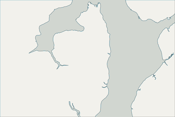
Get to know your waterfront
Fleming Island is a census-designated community in Clay County between the St. Johns River and Doctors Lake, with about 15.8 square miles of land and 7.3 square miles of water. The St. Johns River Water Management District describes Doctors Lake as a 3,400-acre lake with poor circulation because of its narrow connection to the river.
2024 Census Gazetteer: Florida places; USGS GNIS · Doctors Lake restoration projects
Lake shore or river shore?
On Doctors Lake, wave energy is lower than on the open river and circulation is poor, which can make it a candidate for softer or hybrid shoreline treatments where a vertical wall is not essential; ask about the living-shoreline options. On the river side, exposure to long fetch and storm water is greater. Doctors Lake restoration projects · Understanding Living Shorelines
SJRWMD reports a septic-to-sewer project for the lake completed in April 2023, citing 847 septic units as a nutrient source. Water quality does not change wall design, but it matters for any planted shoreline. Doctors Lake restoration projects
Storm reference points
The nearby Buckman Bridge gauge recorded 5.2 feet above normal high water in Irma. Upstream, Irma also drove Black Creek to a record crest near Middleburg. NWPS gauge BUCF1 – St. Johns River at Buckman Bridge · NWPS gauge MDLF1 – North Fork Black Creek near Middleburg
What could the work cost?
Lake-side projects may be smaller and more access-constrained; ask how equipment will reach the wall.
Published prices are attributed planning context from contractors’ own pages, not a measured Jacksonville average or this website’s quote. Ranges differ about five-fold between publishers; your written, itemized scope decides the real number.
Compare quotes and plan a budget →Find the relevant permits and records
| Starting point | What to resolve | Prepare and look up |
|---|---|---|
Florida DEP Northeast District (Jacksonville) | State environmental resource permit or exemption, and state-lands consent for work at or below the high-water line. DEP handles single-family docks and shore protection not tied to a larger development. | Survey with the existing wall face and high-water line, the proposed alignment and photos. DEP Northeast District: 904-256-1700. |
U.S. Army Corps of Engineers, Jacksonville District | Federal authorization for work in tidal and navigable waters, often verified by DEP through the state programmatic general permit or covered by a nationwide permit. | Ask DEP whether its review includes federal verification for your scope, or which nationwide permit applies. |
A Fleming Island checklist
Use these steps to prepare.
Identify your shoreline type
Doctors Lake and the St. Johns River differ in exposure; tell the assessor which one your wall faces.
Check the flood discount
Unincorporated Clay County is CRS class 6, a 20% NFIP discount.
Record storm levels
Use the Buckman Bridge gauge as your local reference for high water.
Plan your Fleming Island & Doctors Lake seawall project
Tell us where your Fleming Island & Doctors Lake property is, what you have noticed and what you want to decide. We will help you plan the next step.
Local guidance. A clearer plan for your waterfront.
Fleming Island & Doctors Lake project questions
Is Doctors Lake tidal?
Doctors Lake connects to the St. Johns River through a narrow mouth, so it follows the river’s small, low tides and storm levels, with poor circulation.
Doctors Lake restoration projects · St. Johns River upriver station datums (8720503, 8720625, 8720774, 8720767, 8720296, 8720333, 8720409, 8720406)
Who issues building permits on Fleming Island?
Fleming Island is unincorporated, so building permits come from the Clay County Building Division rather than a city. Confirm the current submittal process with the county directly; state and federal approvals for work at the water are listed above.
Keep planning
Nearby waterfront guides
Orange Park, Green Cove Springs, Fruit Cove & Julington Creek
Show sourcesHide sources
- 2024 Census Gazetteer: Florida places; USGS GNISSource reviewed 2026-10-24
- Doctors Lake restoration projectsSource reviewed 2026-10-24
- Understanding Living ShorelinesSource reviewed 2026-10-24
- NWPS gauge BUCF1 – St. Johns River at Buckman BridgeSource reviewed 2026-10-24
- NWPS gauge MDLF1 – North Fork Black Creek near MiddleburgSource reviewed 2026-10-24
- Northeast DistrictSource reviewed 2026-10-24
- Operating Agreements ERP Permitting: DEP District Offices and the Water Management District OfficesSource reviewed 2026-10-24
- Operating Agreement Concerning Regulation Under Part IV, Ch. 373, F.S., Between SJRWMD and DEP (eff. 07/01/07)Source reviewed 2026-10-24
- Federal Permits and Coordination Agreements Between DEP, WMDs, and the U.S. Army Corps of EngineersSource reviewed 2026-10-24
- SPGP VI – 1. Shoreline Stabilization, Activity descriptionSource reviewed 2026-10-24
- Reissuance and Modification of Nationwide Permits (91 FR 768, Jan. 8, 2026)Source reviewed 2026-10-24
- CRS Eligible Communities, October 1, 2026 Effective DateSource reviewed 2026-10-24
- St. Johns River upriver station datums (8720503, 8720625, 8720774, 8720767, 8720296, 8720333, 8720409, 8720406)Source reviewed 2026-10-24